
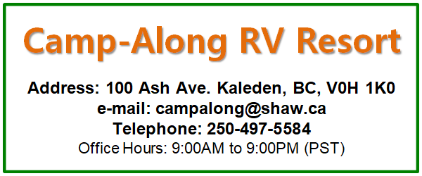
Directions to Camp-Along Resort
Location
From Calgary
Route 1: Via Highway 1 (Trans-Canada Highway)
- Start from Calgary and head west on Highway 1 (Trans-Canada Highway)
- Continue on Highway 1 through Banff National Park (approximately 130 km from Calgary)
- Pass through Golden (approximately 85 km from Banff)
- Continue through Revelstoke (approximately 150 km from Golden)
- Pass through Salmon Arm (approximately 100 km from Revelstoke)
- At Kamloops, take the exit for Highway 97 South (Okanagan Connector) (approximately 100 km from Salmon Arm)
- Follow Highway 97 South through Merritt (approximately 80 km from Kamloops)
- Continue on Highway 97C (Okanagan Connector) to Kelowna (approximately 120 km from Merritt)
- In Kelowna, take Highway 97 South toward Penticton (approximately 60 km from Kelowna)
- Continue on Highway 97 through Penticton
- Take the exit for Highway 3A toward Kaleden (approximately 10 km from Penticton)
- Follow Highway 3A to Kaleden (approximately 5 km)
- Turn right onto Ash Avenue
- Camp-Along Resort is located at 100 Ash Avenue
Approximate driving time: 8-9 hours (approximately 700 km)
This route offers scenic views of the Rocky Mountains and is generally faster in good weather conditions.
Route 2: Via Highway 3 (Crowsnest Highway)
- Start from Calgary and head south on Highway 2 (approximately 50 km from Calgary)
- Turn onto Highway 3 (Crowsnest Highway) at Claresholm (approximately 100 km from Calgary)
- Continue on Highway 3 through Crowsnest Pass (approximately 80 km from Claresholm)
- Pass through Fernie (approximately 30 km from Crowsnest Pass)
- Continue through Cranbrook (approximately 100 km from Fernie)
- Pass through Creston (approximately 100 km from Cranbrook)
- Cross the Kootenay Lake Ferry at Kootenay Bay (approximately 30 km from Creston)
- Continue on Highway 3A to Castlegar (approximately 50 km from the ferry)
- Follow Highway 3 to Grand Forks (approximately 80 km from Castlegar)
- Continue on Highway 3 to Osoyoos (approximately 150 km from Grand Forks)
- In Osoyoos, take Highway 97 North toward Penticton (approximately 60 km from Osoyoos)
- Follow Highway 97 through Oliver and Okanagan Falls (approximately 20 km from Osoyoos)
- Take the exit for Highway 3A toward Kaleden (approximately 10 km from Okanagan Falls)
- Follow Highway 3A to Kaleden (approximately 5 km)
- Turn right onto Ash Avenue
- Camp-Along Resort is located at 100 Ash Avenue
Approximate driving time: 9-10 hours (approximately 750 km)
This route offers a more scenic drive through the Kootenay region and is recommended for those who prefer a less mountainous route.
From Vancouver
Route 1: Via Highway 5 (Coquihalla)
- Take Highway 1 (Trans-Canada Highway) East from Vancouver
- Continue on Highway 1 through Hope
- Take Highway 5 (Coquihalla) North towards Kamloops
- Continue on Highway 5 through Merritt to Kamloops
- In Kamloops, take Highway 97 South towards Kelowna
- Continue on Highway 97 through Kelowna and West Kelowna
- Follow Highway 97 South to Penticton
- Stay on Highway 97 South (bypassing Penticton city center)
- Continue on Highway 97 South for approximately 8 km past Penticton
- Look for Camp-Along Resort on your left side
- Turn left onto Ash Avenue
- Camp-Along Resort will be on your right at 100 Ash Avenue
Approximate driving time: 4-5 hours from Vancouver
Route 2: Via Highway 3 (Crowsnest)
- Take Highway 1 (Trans-Canada Highway) East from Vancouver
- Continue on Highway 1 through Hope
- Take Highway 3 (Crowsnest Highway) East through Manning Park
- Continue on Highway 3 through Princeton
- Stay on Highway 3 through Keremeos
- At Keremeos, take Highway 3A North to Kaleden
- Follow Highway 3A for approximately 3 km to Ash Avenue
- Turn right onto Ash Avenue
- Camp-Along Resort will be on your right at 100 Ash Avenue
Approximate driving time: 5-6 hours from Vancouver
From USA or Osoyoos
- Take Highway 97 North from Osoyoos or the USA border
- Continue on Highway 97 North through Oliver
- Follow Highway 97 North to Okanagan Falls
- Continue on Highway 97 North for approximately 5 km past Okanagan Falls
- Look for Camp-Along Resort on your right side
- Turn right onto Ash Avenue
- Camp-Along Resort will be on your right at 100 Ash Avenue
Approximate driving time: 30-45 minutes from Osoyoos
GPS Coordinates
For GPS navigation, use these coordinates:
- Latitude: 49.4061° N
- Longitude: 119.6053° W